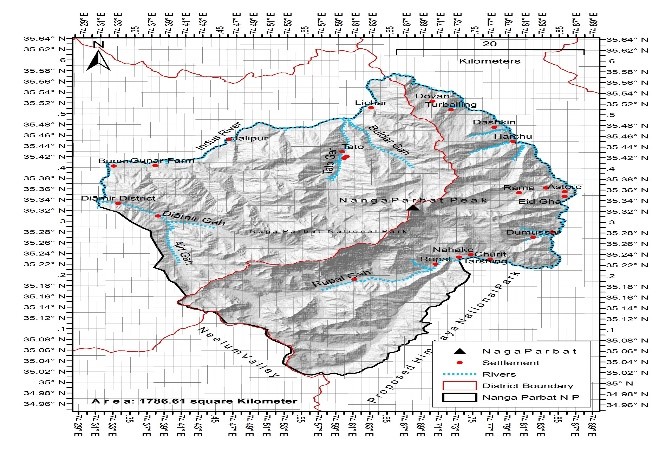
Nanga Parbat National Park (35.16375N, 74.550860E) is recently notified in 2021 and the park is located in Diamer and Astore for protection and conservation of Ladakh Urial and other species. It covers an area of about 178561 hectares around Nanga Parbat Mountain. Established on 2021
Map of Nanga Parbat National Park , Gilgit-Baltistan, Pakistan
Dominant Wildlife and Biodiversity
The Park is the part of conservation and Protection of the wildlife, specifically Ladakh Urial and other species. It is the home to dry temperate coniferous forest, Alpine meadows and Alpine scrub zone, Montane dry sub-tropical scrub zone in the hub of majestic beauties that include Killer Mountain (Nanga parbat), Rupal peak, Shaigiri peak, Bazhin Glacier, Fairy meadows, Rama lake and Mazhino pass. Its climate naturally offers a variety of flora and fauna that includes Musk deer, Brown bear, Black Bear, Markhor, Ladakh urial, Fox, Wolf, Stone martin, weasel with birds Monal pheasant, , magpie, Himalayan Griffon vulture. and well scattered Spruce, Birch, blue pine, Juniperus spp, fir, willow, and Sea Buckthorn.
Dominant Fauna
Mammals
Musk deer Brown bear Black Bear Himalayan ibex Markhor Ladakh urial Marmot Fox Wolf lynx leopard cat Stone martin weasel